Platform
Draw and edit a site map right on the map
Draw a property's site boundary and building footprints directly on a satellite map, and get interior and site square footage without leaving the page.
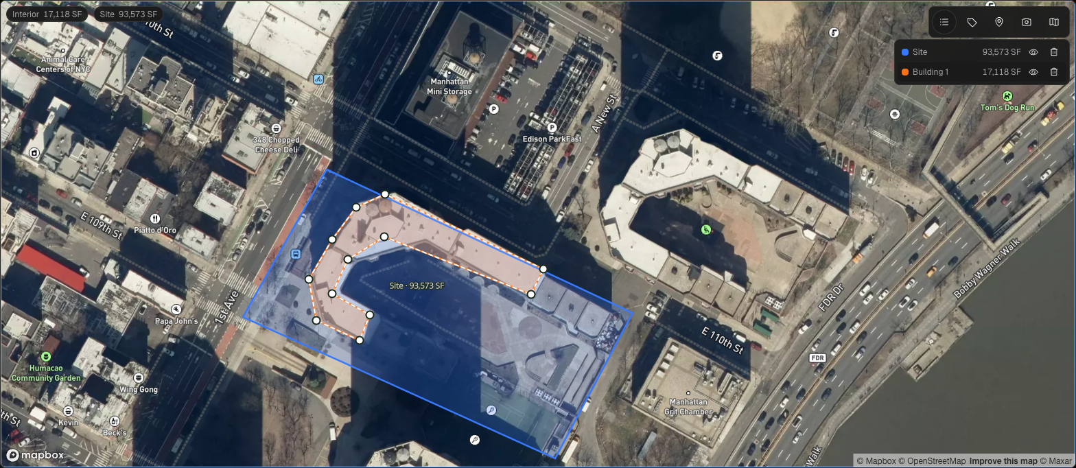

Draw a property's site boundary and building footprints directly on a satellite map, and get interior and site square footage without leaving the page.
The problem
Getting a property's footprint and square footage onto an order used to mean working outside the platform: sketching in another tool, estimating sqft by hand, then re-entering it. There was no single place to see a location's site map, update it, and carry it forward into new orders.
How it works
The Site Map editor lets you draw a site boundary and one or more building footprints on a satellite map. As you draw, the editor computes interior and site square footage and lists each area so you can hide, delete, or select it. Buildings you draw also register in Building Levels, so the footprint and the square footage stay connected to the rest of the project.
You can snapshot the map with a legend and labels, then download it or attach it directly to the project's references and images. On a location's Map tab, an inline editor replaces the old modal: view, create, or edit a project's saved site map right in place. A Site Map toolbar popover lets you pick which project's map to show, hide it, edit it, or start a new one for a project that doesn't have one yet. Saved maps render as a read-only overlay with colored fills and labels, and stay in place when you switch between map and satellite views.
Site maps carry forward automatically. When you start a new order for a location, its most recent site map loads in automatically. If nothing changed, reuse it as-is with no duplicate created. If you edit it, the new version saves onto the new project while the original stays with the project it came from.
Getting started
Open a location's Map tab to view or create its site map, or start a new service request and let the site map auto-load from the location's most recent one. Use the toolbar popover to switch between projects' maps, and use Snapshot to download or attach a legend-labeled image to the project.
Good to know
Autosave runs in the background as you draw, and your work is saved when you close the editor or switch locations, so you won't lose a map mid-edit.